Showing posts with label India. Show all posts

Warangal Fort - Andhra Pradesh

Warangal also known as Orugallu, and Ekasila Nagaram) is a city and a municipal corporation in Warangal district in the Indian state of Andhra Pradesh. Warangal is located 148 kilometres (92 mi) northeast of the state capital of Hyderabad and is the administrative headquarters of Warangal District. Warangal metropolitan area is a combination of three cities: Warangal, Hanamakonda and Kazipet. It has a population of nearly 0.9 million including Hanamakonda and Kazipet.


Warangal city is the headquarters of Warangal district. Warangal district contributes a total of twelve seats (city has two; that of Warangal East and Warangal West) in the lower house of the State Legislature and two seats (Warangal and Mahabubabad) in lower house of Indian Parliament.

Panoramic picture of the ruins of the Warangal fortPanoramic picture of the ruins of the Warangal fort.

Gooty Fort - Andhra Pradesh

Gooty (pronounced 'Gutti') is a census town in Anantapur district in the Indian state of Andhra Pradesh. The history of Gooty dates back to the 7th century when it was previously known as Gowthamapuri. The region of Gooty was first under the rule of king Ashoka and there is a Minor Rock Edict in Yerraguda (6 km from Gooty). In the subsequent centuries Gooty was under the rule of Sri Krishnadevaraya's Vijayanagara empire. The Pemmasani Nayaks of Gandikota controlled Gooty as subordinates of Vijayanagar kings. Later, it came under the control of Hyder Ali and Tipu Sultan of the Kingdom of Mysore.


As of 2001 India census,[1] Gooty had a population of 43,387. Males constitute 51% of the population and females 49%. Gooty has an average literacy rate of 65%, higher than the national average of 59.5%: male literacy is 74%, and female literacy is 55%. In Gooty, 12% of the population is under 6 years of age.


The town has one of the oldest hill forts of Andhra Pradesh. The earliest inscriptions are in Kannada and Sanskrit, and are assigned to about the 7th century. An inscription refers to a fort, 'Gadha', while an inscription of Bukka, the Vijayanagar monarch, refers to it as the 'King of Forts'. The Marathas under Murari Rao conquered it. As per District gazetteer of Tiruchinapalli, Gooty Fort was under Subedar of Trichy Fort.
The 'Gooty Kaifiyat' records that this fort was captured by Mir Jumla and was subsequently under the charge of Qutub Shahi chiefs. It was taken over by Hyder Ali in 1773 and eventually fell into the British hands. The British Col. Browser, who attacked and finally took over the fort, found it to be commanded by a Zeruwar Khan, a Brahmin who became Muslim. The fort is situated at a height of 300m above the plains in Gooty.
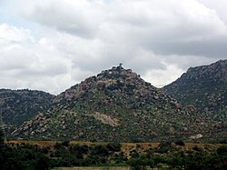
The citadel of the fort is constructed on the westernmost circle of hillocks. It is a huge precipitous mass of bare rock and towers over the adjacent ones.
The fort is approached by a paved path leading first to an outlying spur strongly fortified and known in former days as 'Mar Gooty'. After passing through the fortifications, the pathway winds upward round steep sides of huge rock and reaches the summit where the citadel or 'qila' is situated.
The fort is built in shape of a shell and having 15 forts with 15 main doors ('Mukhadwaralu'). The fortifications include a series of walls connected by 14 gateways flanked by bastions. None of the buildings in the fort is of any architectural importance. There are two edifices, apparently a gymnasium and a powder magazine, and a small pavilion of polished lime stone called Morari Rao's seat, on the edge of the cliff. This commands excellent view of the town below and is said to have been a favourite resort of Morari Rao. There are also number of wells in the clefts of the rock. One of them is believed to have been connected with a stream at the foot of the hill.

Penukonda


According to The Imperial Gazetteer of India,[2] Penukonda was a subdivision and taluk of Anantapur district in Madras province. It contains 96 villages covering an area of 677 square miles. The population in 1901 was 92,482, compared with 81,104 in 1891. Penukonda was the headquarters town with a population of 6,806. It is situated at the base of a large hill (Konda in Telugu language), from which it takes the name. It is a place of historical importance. It became the capital of fallen Vijayanagar monarch, after he was overthrown in 1565 at the Battle of Talikota. The Penner River flows along its western and Chitravati river along its eastern boundary.

This region was controlled at different points in history by the Hoysalas, Chalukyas, Vijayanagar, Nawabs, Maratha chieftain Murari Rao, Tipu Sultan, Nizam and eventually came under British rule after it was ceded to the British by the Nizam of Hyderabad. It was a melting pot of different religions but the town and fort were established by early Hoysala kings, who were practitioners of Jainism.
After Krishna Deva Raya, Venkatapathi Rayalu, the Emperor of Vijayanagar, took over. He made Raya Dalavayi Koneti Naidu (son of Kasturi Naidu, grandson of Akkappa Naidu, great-grandson of Kanaka Naidu of Chandragiri), as the governor of Penukonda and conferred him the title with Maha-raja-raja-sri and celebrated Koneti Naidu's marriage to Swarna. Koneti Naidu hailed from the Vasarasi family of Balija caste. Koneti Naidu ruled Penukonda, Rayadurga and Kundurpi Forts for about 17 years (1635-1652AD). After the ruling of Koneti Nayudu his descendants Raya Dalavayi Sri Venkatapathi Nayudu, Peda Timmappa Nayudu, Venkatapathi Nayudu, Koneti Nayudu, Rajagopala Nayudu and Timmappa Nayudu ruled this Penukonda country.
Because of its ancient Jain history and presence of many temples it is one of the most revered places for Jains. The famous Pache Parsvanath Swamy Temple, with idol of Parsvanath containing a single green coloured stone (Pacha) is located here. The famous Babaiah Dargah makes this place venerable to Muslims as well.
Hazrath Baba Fakruddin was a great Sufi Saint of 12th century. Purportedly before coming to Penukonda, he was a king of Sistan and Shahpur in Iran. Legend says that he was searching for a place to settle and his Guru gave him a dry twig and said to him: ..wherever this twig will bloom to a big plant stay there... He planted the twig and slept under a tree only to awake and saw it become a beautiful plant and he stayed there. He is called Babaiah by the local people and due to the love and respect he garnered, many men of various faiths have taken his name over centuries.

Charminar


Charminar

Charminar, which is synonymous with Hyderabad is one of the magnificent structures built by Mohammad Quli Qutub Shah, the fifth ruler of the Qutub Shahi dynasty and also the founder of the City, in Hijri 1000 (A.D.1591-92). This is a square structure measuring 31.95 mts. on each side with imposing arches spanning a distance of 11mts. There are four minarets, each having three storeyes, rising to a height of 56 mts. The spiral staircase inside the minarets has 149 steps leading to the top with 12 landings. The double screen of arches on the roof and the ornamental arches on the minarets add to the aesthetic value.

The notable feature of Charminar is the location of a mosque on the western section of the second floor, probably one of the most beautiful of this period. There are forty-five mushallas (prayer spaces) with an open courtyard in front.

The structure is also known for its profuseness of stucco decorations and arrangement of balustrades and balconies. The floral designs are varied and delicately executed. It was a synthesis of Mughal and Hindu architecture executed by the local artisans.

There are various theories regarding the purpose for which Charminar was constructed. However, it is widely accepted that Charminar was built at the center of the city, to commemorate the eradication of plague. In the middle of the eighteenth century, Bussy the French Commander made Charminar his headquarters.

The four clocks were added later, on the four cardinal directions in the year 1889. At the base of Charminar was originally a Vazu (water cistern) at the center with a small fountain for customary ablutions, before offering prayers in the mosque.

Golkonda Fort


Golkonda Fort


Lying to the west of Hyderabad city at a distance of 11 km, the historic Golkonda Fort derives its name from a Telugu word ‘Golla Konda’ which means Shepherd’s Hill. With its extensive and elevated fortifications it was a landmark that governed the destiny of the south. The fort originally belonged to the Kakatiyas of Warangal. This is testified by the over-door carvings and relief work in stucco consisting of lions, peacocks, griffins and lotus at the entrance of Balahisar. In AD1363 it was ceded to the Baihmanis. After their downfall in AD1518 it became the capital of the Qutb Shahi kings (AD 1518-1687). The fort was extended and substantially strengthened by these kings with massive fortification walls having bastions and battlements. Subsequently Aurangazeb annexed it to the Moghal Empire (AD 1687) during the reign of Abul Hasan Tana Shan, the last ruler of the Qutb Shahi dynasty and appointed Asaf Jah as the Subedar of the Deccan province. Asaf Jah declared independence in AD1713 as Nizam-ul-Mulk and the Nizams held sway over Hyderabad until AD 1948.

Golkonda fort, one of the most famous and the biggest fortress in the Deccan plateau, was built on a 400 ft. high hill. It has three lines of massive fortification walls one within the other and rise to a height of over 12 m. The outer most wall was provided with a deep moat all around covering a vast area of the town with a circumference of 7 km. It has 8 imposing gateways and is buttressed with 87 bastions rising to a height of 15 to 18 meters. Each of these bastions was surmounted by cannons of varying caliber rendering the fort impregnable and strong among the forts of the medieval Deccan.

After the outer wall it has also a double wall that runs around the foot of the hill on which the citadel stands. Within the double wall, winding further up the hill, connecting the natural boulders with masonry walls is a third wall. An extension of the outer wall was made to enclose a small area on the northeast of the town in 1724 AD, which is now known as Naya Qila. The well-planned township of Golconda located within the fort was one of the splendid cities famous during the medieval world for its extensive trade in gems and diamonds as attested to by foreigners like Marco Polo, an Italian traveler. The fort has a striking appearance and its higher area is covered with the remains of armories, magazines, mosques, granaries, reservoirs and audience chambers; while at the foot of the citadel are nestled the dwellings of the queens and princesses and homesteads of their retainers.

The fort has an ingeniously evolved water supply system. The water raised by Persian wheels was stored in overhead tanks at different levels. Water thus collected was effectively distributed to various mahals, other apartments, roof gardens and fountains in the citadel through stone aqueducts and a network of earthen pipes by sheer force of gravity.

The important structures inside the citadel or balahissar are the imposing Silai Khana ( a three-storied Aslah Khana – armoury building), Nagina bagh, guard lines, Akkanna-Madanna Offices, Ramdas Jail, Darbar hall, ruins of Ambar khana, Baradari on the summit, an inner cordon wall, and a Masjid raised by Ibrahim Qutub Shah (1550-1580 AD). The east gateway is the only entrance to the citadel and it is one of the biggest gates in the entire fort.

Signalling Device (Acoustic property): - A remarkable signaling device had been incorporated in the construction of Golconda Fort. The various edifices are so placed as to transmit sound to different far away points. If one stands at the center of the entrance portal and claps the sound is deflected by the opposite building, which is constructed at an angle to the entrance. Similarly if clapping sound is made from the opposite building, it will be carried to the hilltop, although at the other close points it may not be heard. It is believed that this was deliberately contrived to convey a message to the guards posted on the roof of darbar hall regarding the visiting dignitaries.

The other buildings found inside the fort are Habshi Kamans (Abyssian arches), Ashlah Khana, Taramati mosque,camel stable, private chambers (kilwat), Mortuary bath, Nagina bagh, Ramasasa's kotha, Durbar hall, Ambar khana etc. 

Photo Gallery

Evening Show @ Gokonda Fort