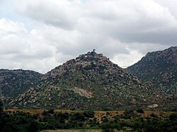
Warangal city is the headquarters of Warangal district. Warangal district contributes a total of twelve seats (city has two; that of Warangal East and Warangal West) in the lower house of the State Legislature and two seats (Warangal and Mahabubabad) in lower house of Indian Parliament.
Showing posts with label HERITAGE. Show all posts
Warangal Fort - Andhra Pradesh
Warangal also known as Orugallu, and Ekasila Nagaram) is a city and a municipal corporation in Warangal district in the Indian state of Andhra Pradesh. Warangal is located 148 kilometres (92 mi) northeast of the state capital of Hyderabad and is the administrative headquarters of Warangal District. Warangal metropolitan area is a combination of three cities: Warangal, Hanamakonda and Kazipet. It has a population of nearly 0.9 million including Hanamakonda and Kazipet.

Warangal city is the headquarters of Warangal district. Warangal district contributes a total of twelve seats (city has two; that of Warangal East and Warangal West) in the lower house of the State Legislature and two seats (Warangal and Mahabubabad) in lower house of Indian Parliament.

Warangal city is the headquarters of Warangal district. Warangal district contributes a total of twelve seats (city has two; that of Warangal East and Warangal West) in the lower house of the State Legislature and two seats (Warangal and Mahabubabad) in lower house of Indian Parliament.
Gooty Fort - Andhra Pradesh
Gooty (pronounced 'Gutti') is a census town in Anantapur district in the Indian state of Andhra Pradesh. The history of Gooty dates back to the 7th century when it was previously known as Gowthamapuri. The region of Gooty was first under the rule of king Ashoka and there is a Minor Rock Edict in Yerraguda (6 km from Gooty). In the subsequent centuries Gooty was under the rule of Sri Krishnadevaraya's Vijayanagara empire. The Pemmasani Nayaks of Gandikota controlled Gooty as subordinates of Vijayanagar kings. Later, it came under the control of Hyder Ali and Tipu Sultan of the Kingdom of Mysore.

As of 2001 India census,[1] Gooty had a population of 43,387. Males constitute 51% of the population and females 49%. Gooty has an average literacy rate of 65%, higher than the national average of 59.5%: male literacy is 74%, and female literacy is 55%. In Gooty, 12% of the population is under 6 years of age.
The town has one of the oldest hill forts of Andhra Pradesh. The earliest inscriptions are in Kannada and Sanskrit, and are assigned to about the 7th century. An inscription refers to a fort, 'Gadha', while an inscription of Bukka, the Vijayanagar monarch, refers to it as the 'King of Forts'. The Marathas under Murari Rao conquered it. As per District gazetteer of Tiruchinapalli, Gooty Fort was under Subedar of Trichy Fort.
The 'Gooty Kaifiyat' records that this fort was captured by Mir Jumla and was subsequently under the charge of Qutub Shahi chiefs. It was taken over by Hyder Ali in 1773 and eventually fell into the British hands. The British Col. Browser, who attacked and finally took over the fort, found it to be commanded by a Zeruwar Khan, a Brahmin who became Muslim. The fort is situated at a height of 300m above the plains in Gooty.
The citadel of the fort is constructed on the westernmost circle of hillocks. It is a huge precipitous mass of bare rock and towers over the adjacent ones.
The fort is approached by a paved path leading first to an outlying spur strongly fortified and known in former days as 'Mar Gooty'. After passing through the fortifications, the pathway winds upward round steep sides of huge rock and reaches the summit where the citadel or 'qila' is situated.
The fort is built in shape of a shell and having 15 forts with 15 main doors ('Mukhadwaralu'). The fortifications include a series of walls connected by 14 gateways flanked by bastions. None of the buildings in the fort is of any architectural importance. There are two edifices, apparently a gymnasium and a powder magazine, and a small pavilion of polished lime stone called Morari Rao's seat, on the edge of the cliff. This commands excellent view of the town below and is said to have been a favourite resort of Morari Rao. There are also number of wells in the clefts of the rock. One of them is believed to have been connected with a stream at the foot of the hill.
As of 2001 India census,[1] Gooty had a population of 43,387. Males constitute 51% of the population and females 49%. Gooty has an average literacy rate of 65%, higher than the national average of 59.5%: male literacy is 74%, and female literacy is 55%. In Gooty, 12% of the population is under 6 years of age.
The town has one of the oldest hill forts of Andhra Pradesh. The earliest inscriptions are in Kannada and Sanskrit, and are assigned to about the 7th century. An inscription refers to a fort, 'Gadha', while an inscription of Bukka, the Vijayanagar monarch, refers to it as the 'King of Forts'. The Marathas under Murari Rao conquered it. As per District gazetteer of Tiruchinapalli, Gooty Fort was under Subedar of Trichy Fort.
The 'Gooty Kaifiyat' records that this fort was captured by Mir Jumla and was subsequently under the charge of Qutub Shahi chiefs. It was taken over by Hyder Ali in 1773 and eventually fell into the British hands. The British Col. Browser, who attacked and finally took over the fort, found it to be commanded by a Zeruwar Khan, a Brahmin who became Muslim. The fort is situated at a height of 300m above the plains in Gooty.
The citadel of the fort is constructed on the westernmost circle of hillocks. It is a huge precipitous mass of bare rock and towers over the adjacent ones.
The fort is approached by a paved path leading first to an outlying spur strongly fortified and known in former days as 'Mar Gooty'. After passing through the fortifications, the pathway winds upward round steep sides of huge rock and reaches the summit where the citadel or 'qila' is situated.
The fort is built in shape of a shell and having 15 forts with 15 main doors ('Mukhadwaralu'). The fortifications include a series of walls connected by 14 gateways flanked by bastions. None of the buildings in the fort is of any architectural importance. There are two edifices, apparently a gymnasium and a powder magazine, and a small pavilion of polished lime stone called Morari Rao's seat, on the edge of the cliff. This commands excellent view of the town below and is said to have been a favourite resort of Morari Rao. There are also number of wells in the clefts of the rock. One of them is believed to have been connected with a stream at the foot of the hill.
Penukonda
According to The Imperial Gazetteer of India,[2] Penukonda was a subdivision and taluk of Anantapur district in Madras province. It contains 96 villages covering an area of 677 square miles. The population in 1901 was 92,482, compared with 81,104 in 1891. Penukonda was the headquarters town with a population of 6,806. It is situated at the base of a large hill (Konda in Telugu language), from which it takes the name. It is a place of historical importance. It became the capital of fallen Vijayanagar monarch, after he was overthrown in 1565 at the Battle of Talikota. The Penner River flows along its western and Chitravati river along its eastern boundary.
This region was controlled at different points in history by the Hoysalas, Chalukyas, Vijayanagar, Nawabs, Maratha chieftain Murari Rao, Tipu Sultan, Nizam and eventually came under British rule after it was ceded to the British by the Nizam of Hyderabad. It was a melting pot of different religions but the town and fort were established by early Hoysala kings, who were practitioners of Jainism.
After Krishna Deva Raya, Venkatapathi Rayalu, the Emperor of Vijayanagar, took over. He made Raya Dalavayi Koneti Naidu (son of Kasturi Naidu, grandson of Akkappa Naidu, great-grandson of Kanaka Naidu of Chandragiri), as the governor of Penukonda and conferred him the title with Maha-raja-raja-sri and celebrated Koneti Naidu's marriage to Swarna. Koneti Naidu hailed from the Vasarasi family of Balija caste. Koneti Naidu ruled Penukonda, Rayadurga and Kundurpi Forts for about 17 years (1635-1652AD). After the ruling of Koneti Nayudu his descendants Raya Dalavayi Sri Venkatapathi Nayudu, Peda Timmappa Nayudu, Venkatapathi Nayudu, Koneti Nayudu, Rajagopala Nayudu and Timmappa Nayudu ruled this Penukonda country.
Because of its ancient Jain history and presence of many temples it is one of the most revered places for Jains. The famous Pache Parsvanath Swamy Temple, with idol of Parsvanath containing a single green coloured stone (Pacha) is located here. The famous Babaiah Dargah makes this place venerable to Muslims as well.
Hazrath Baba Fakruddin was a great Sufi Saint of 12th century. Purportedly before coming to Penukonda, he was a king of Sistan and Shahpur in Iran. Legend says that he was searching for a place to settle and his Guru gave him a dry twig and said to him: ..wherever this twig will bloom to a big plant stay there... He planted the twig and slept under a tree only to awake and saw it become a beautiful plant and he stayed there. He is called Babaiah by the local people and due to the love and respect he garnered, many men of various faiths have taken his name over centuries.
Charminar
Charminar
Charminar, which is synonymous with Hyderabad is one of the magnificent structures built by Mohammad Quli Qutub Shah, the fifth ruler of the Qutub Shahi dynasty and also the founder of the City, in Hijri 1000 (A.D.1591-92). This is a square structure measuring 31.95 mts. on each side with imposing arches spanning a distance of 11mts. There are four minarets, each having three storeyes, rising to a height of 56 mts. The spiral staircase inside the minarets has 149 steps leading to the top with 12 landings. The double screen of arches on the roof and the ornamental arches on the minarets add to the aesthetic value.
The notable feature of Charminar is the location of a mosque on the western section of the second floor, probably one of the most beautiful of this period. There are forty-five mushallas (prayer spaces) with an open courtyard in front.
The structure is also known for its profuseness of stucco decorations and arrangement of balustrades and balconies. The floral designs are varied and delicately executed. It was a synthesis of Mughal and Hindu architecture executed by the local artisans.
There are various theories regarding the purpose for which Charminar was constructed. However, it is widely accepted that Charminar was built at the center of the city, to commemorate the eradication of plague. In the middle of the eighteenth century, Bussy the French Commander made Charminar his headquarters.
The four clocks were added later, on the four cardinal directions in the year 1889. At the base of Charminar was originally a Vazu (water cistern) at the center with a small fountain for customary ablutions, before offering prayers in the mosque.
The notable feature of Charminar is the location of a mosque on the western section of the second floor, probably one of the most beautiful of this period. There are forty-five mushallas (prayer spaces) with an open courtyard in front.
The structure is also known for its profuseness of stucco decorations and arrangement of balustrades and balconies. The floral designs are varied and delicately executed. It was a synthesis of Mughal and Hindu architecture executed by the local artisans.
There are various theories regarding the purpose for which Charminar was constructed. However, it is widely accepted that Charminar was built at the center of the city, to commemorate the eradication of plague. In the middle of the eighteenth century, Bussy the French Commander made Charminar his headquarters.
The four clocks were added later, on the four cardinal directions in the year 1889. At the base of Charminar was originally a Vazu (water cistern) at the center with a small fountain for customary ablutions, before offering prayers in the mosque.
Golkonda Fort
Golkonda Fort
Lying to the west of Hyderabad city at a distance of 11 km, the historic Golkonda Fort derives its name from a Telugu word ‘Golla Konda’ which means Shepherd’s Hill. With its extensive and elevated fortifications it was a landmark that governed the destiny of the south. The fort originally belonged to the Kakatiyas of Warangal. This is testified by the over-door carvings and relief work in stucco consisting of lions, peacocks, griffins and lotus at the entrance of Balahisar. In AD1363 it was ceded to the Baihmanis. After their downfall in AD1518 it became the capital of the Qutb Shahi kings (AD 1518-1687). The fort was extended and substantially strengthened by these kings with massive fortification walls having bastions and battlements. Subsequently Aurangazeb annexed it to the Moghal Empire (AD 1687) during the reign of Abul Hasan Tana Shan, the last ruler of the Qutb Shahi dynasty and appointed Asaf Jah as the Subedar of the Deccan province. Asaf Jah declared independence in AD1713 as Nizam-ul-Mulk and the Nizams held sway over Hyderabad until AD 1948.
Golkonda fort, one of the most famous and the biggest fortress in the Deccan plateau, was built on a 400 ft. high hill. It has three lines of massive fortification walls one within the other and rise to a height of over 12 m. The outer most wall was provided with a deep moat all around covering a vast area of the town with a circumference of 7 km. It has 8 imposing gateways and is buttressed with 87 bastions rising to a height of 15 to 18 meters. Each of these bastions was surmounted by cannons of varying caliber rendering the fort impregnable and strong among the forts of the medieval Deccan.
After the outer wall it has also a double wall that runs around the foot of the hill on which the citadel stands. Within the double wall, winding further up the hill, connecting the natural boulders with masonry walls is a third wall. An extension of the outer wall was made to enclose a small area on the northeast of the town in 1724 AD, which is now known as Naya Qila. The well-planned township of Golconda located within the fort was one of the splendid cities famous during the medieval world for its extensive trade in gems and diamonds as attested to by foreigners like Marco Polo, an Italian traveler. The fort has a striking appearance and its higher area is covered with the remains of armories, magazines, mosques, granaries, reservoirs and audience chambers; while at the foot of the citadel are nestled the dwellings of the queens and princesses and homesteads of their retainers.
The fort has an ingeniously evolved water supply system. The water raised by Persian wheels was stored in overhead tanks at different levels. Water thus collected was effectively distributed to various mahals, other apartments, roof gardens and fountains in the citadel through stone aqueducts and a network of earthen pipes by sheer force of gravity.
The important structures inside the citadel or balahissar are the imposing Silai Khana ( a three-storied Aslah Khana – armoury building), Nagina bagh, guard lines, Akkanna-Madanna Offices, Ramdas Jail, Darbar hall, ruins of Ambar khana, Baradari on the summit, an inner cordon wall, and a Masjid raised by Ibrahim Qutub Shah (1550-1580 AD). The east gateway is the only entrance to the citadel and it is one of the biggest gates in the entire fort.
Signalling Device (Acoustic property): - A remarkable signaling device had been incorporated in the construction of Golconda Fort. The various edifices are so placed as to transmit sound to different far away points. If one stands at the center of the entrance portal and claps the sound is deflected by the opposite building, which is constructed at an angle to the entrance. Similarly if clapping sound is made from the opposite building, it will be carried to the hilltop, although at the other close points it may not be heard. It is believed that this was deliberately contrived to convey a message to the guards posted on the roof of darbar hall regarding the visiting dignitaries.
The other buildings found inside the fort are Habshi Kamans (Abyssian arches), Ashlah Khana, Taramati mosque,camel stable, private chambers (kilwat), Mortuary bath, Nagina bagh, Ramasasa's kotha, Durbar hall, Ambar khana etc.
Golkonda fort, one of the most famous and the biggest fortress in the Deccan plateau, was built on a 400 ft. high hill. It has three lines of massive fortification walls one within the other and rise to a height of over 12 m. The outer most wall was provided with a deep moat all around covering a vast area of the town with a circumference of 7 km. It has 8 imposing gateways and is buttressed with 87 bastions rising to a height of 15 to 18 meters. Each of these bastions was surmounted by cannons of varying caliber rendering the fort impregnable and strong among the forts of the medieval Deccan.
After the outer wall it has also a double wall that runs around the foot of the hill on which the citadel stands. Within the double wall, winding further up the hill, connecting the natural boulders with masonry walls is a third wall. An extension of the outer wall was made to enclose a small area on the northeast of the town in 1724 AD, which is now known as Naya Qila. The well-planned township of Golconda located within the fort was one of the splendid cities famous during the medieval world for its extensive trade in gems and diamonds as attested to by foreigners like Marco Polo, an Italian traveler. The fort has a striking appearance and its higher area is covered with the remains of armories, magazines, mosques, granaries, reservoirs and audience chambers; while at the foot of the citadel are nestled the dwellings of the queens and princesses and homesteads of their retainers.
The fort has an ingeniously evolved water supply system. The water raised by Persian wheels was stored in overhead tanks at different levels. Water thus collected was effectively distributed to various mahals, other apartments, roof gardens and fountains in the citadel through stone aqueducts and a network of earthen pipes by sheer force of gravity.
The important structures inside the citadel or balahissar are the imposing Silai Khana ( a three-storied Aslah Khana – armoury building), Nagina bagh, guard lines, Akkanna-Madanna Offices, Ramdas Jail, Darbar hall, ruins of Ambar khana, Baradari on the summit, an inner cordon wall, and a Masjid raised by Ibrahim Qutub Shah (1550-1580 AD). The east gateway is the only entrance to the citadel and it is one of the biggest gates in the entire fort.
Signalling Device (Acoustic property): - A remarkable signaling device had been incorporated in the construction of Golconda Fort. The various edifices are so placed as to transmit sound to different far away points. If one stands at the center of the entrance portal and claps the sound is deflected by the opposite building, which is constructed at an angle to the entrance. Similarly if clapping sound is made from the opposite building, it will be carried to the hilltop, although at the other close points it may not be heard. It is believed that this was deliberately contrived to convey a message to the guards posted on the roof of darbar hall regarding the visiting dignitaries.
The other buildings found inside the fort are Habshi Kamans (Abyssian arches), Ashlah Khana, Taramati mosque,camel stable, private chambers (kilwat), Mortuary bath, Nagina bagh, Ramasasa's kotha, Durbar hall, Ambar khana etc.
Photo Gallery -
| Evening Show @ Gokonda Fort |
Victoria Falls Between Zambia & Zimbabwe
| Victoria Water Falls |
Victoria Falls of Zambia and Zimbabwe is one of the world’s most spectacular natural wonders, and it appeals to travelers across the globe. The Zambezi River flows placid and broad to the edge of a basalt lip measuring 1700 meters before plunging 100 meters into the frothy, thunderous abyss below.
History
The history of Victoria Falls does not go back. The first European who saw the falls was David Livingstone in November of 1855. However, today the falls continues to be as allusive a destination as it was to the explorers, surveyors, missionaries, and hunters of the 1800s. The impulse to travel to the falls is the same, but the pursuit is only a little bit different.
Adventure
Victoria Falls is the biggest waterfall in the whole world, and it serves as a safari gateway for Southern Africa. The falls has become a very popular place for visitors to go white water rafting, river boarding, and even bungee jumping. The downstream rapids of the river after the falls provide some of the scariest river boarding and white water rafting for beginners, as well as those who have experience, than anywhere else.
Activities
Bungee jumpers also enjoy the thrill of Victoria Falls, where they can jump down 111 meters off of the bridge by the falls, which was just recently named the highest commercial bungee jump in the world. Aside from rafting and bungee jumping, however, visitors can also enjoy bird watching, aerial trips on a helicopter, walking trails, shopping, etc. as well.
Pictures & Photos
| Victoria Falls With Rainbow |
| Bride at Victoria Falls |
| The Eastern Cataract, on the Zambian side |
| Victoria Falls Bridge |
| Sunset Over Victoria Falls |
| Turbulent waters of Zambezi River Rush Victoria Falls Forming Rainbow |
| Bottom of a Falls |
| Another Shot of Victoria Falls |
| Side view of Victoria Waterfalls |
| Another Sunset of Victoria Water Falls |
| River path of the Victoria Water falls |
| Royal Livingstone Hotel in Zambia Near Victoria Falls |
| Main Part of Victoria Water Falls |
| "Devil Swimming Pool" - Is This Safe? |
| View of Victoria Falls From the Sky in 1972 |
Petra - Half as old as Time
Situated between the Red Sea and the Dead Sea in the Hashemite Kingdom of Jordan, the Nabatean city of Petra is considered among the Seven Wonders of the World. In the description of the “universal outstanding value” of this World Heritage Site, UNESCO describes the ancient city as a “major caravan centre for the incense of Arabia, the silks of China and the spices of India, a crossroads between Arabia, Egypt and Syria-Phoenicia.” The poet John William Burgon memorably described the spellbinding ruins of Petra as “a rose-red city half as old as time.” Around AD 663, an earthquake destroyed parts of Petra and choked water supply, leading to its abandonment. The city remained lost to the world until the Swiss explorer Johann Ludwig Burckhardt, in the guise of an Arabic scholar, rediscovered it for the Western world. LAKSHMI SHARATH takes you on a visual tour of the awe-inspiring ruins of Petra.
Petra, a world hidden within the mountains of Jordan, was built several centuries ago. This ancient "caravan city" was the capital of the Nabataean Arabs, an ancient Semitic race of people who inhabited Jordan. They were mostly traders and agriculturists.
Asia's beautiful heritage temples
Are you an architecture and culture enthusiast? Then you probably know that India is not the only place in the world that boasts beautiful temples. Enjoy this fascinating photo feature on temples around the world.
A view of the impressive Sun Temple in Modhera, Gujarat. The eight Dikpalas are the Guardians of Direction, guarding specific directions of space. They are traditionally represented on the walls and ceilings of Hindu temples.
Built of soft bluish-grey soapstone, the Chennakeshava temple at Belur, Karnataka is a jewel of Hoysala architecture.
The Hoysaleshwara temple at Halebeedu in Hassan district, Karnataka, is a survivor of centuries. It has two shrines dedicated to Lord Shiva. Hoysaleshwara and Shanthaleshwara are the two deities.
The cave temple at Seeyamangalam, 80 km from Chennai, was constructed by the Pallava king Mahendravarman I in the 7th century. The temple is dedicated to Stambeshwara, a form of Shiva.
The Chausat Yogini Temple, or the temple of 64 yoginis, is located atop a hill in Bedaghat, some 20 km from Jabalpur in Madhya Pradesh.
Thanjavur, Tamil Nadu
Thanjavur, 342 km from Chennai is where Tamil Nadu's cultural heart beats. Its monumental shrine to Brihadishwara called a Great Living Chola Temple. Built by Raja Raja Chola I in 1011 to commemorate the victory of the Chola dynasty, this architectural gem remains brings together religious fervor and architectural grandeur as it did centuries ago.
Orchha, Madhya Pradesh
Built on the Betwa River in Madhya Pradesh, the ancient city of Orchha houses the citadels and cenotaphs of the Bundela rulers.
Tungnath
Tungnath, at 12,073 above mean sea level, is the highest Shiva temple in the world, discounting perhaps the Amarnath Cave shrine near Srinagar, Kashmir, which is situated at an altitude of 12,756 feet. Tungnath is second in importance among the five mountain shrines collectively known as the Panch Kedar and is situated in Uttarakhand's Garhwal Himalaya.
Hampi, Karnataka
Hampi, on the banks of the Tungabhadra River, was the ancient capital of the glorious Vijayanagar Empire. The ruins of the Achyuta Raya temple here look so serene and beautiful that one can only wonder how grand the temple must have looked 500 years ago.
Hoysala Temples
Nearly everybody has visited the spectacular Hoysala temples of Belur, Halebeedu and Somnathpur. Off the tourist map lie several others. Many are located deep inside forests and coffee plantations.
Siem Reap, Cambodia
Thought Angkor Wat was synonymous with Siem Reap? Think again. Once you are done with the sunrise and sunset and the tour of Angkor Wat, do not head back to the next destination in Cambodia. Buy yourself a three-day Angkor pass and visit other marvelous temples and you will find a slice of ancient civilization waiting for you.
Bali, Indonesia
The Indonesian island of Bali is home to the majority of the country’s Hindus. Balinese Hinduism is characterized by the worship of the supreme god Acintya, along with the trinity in Brahma, Vishnu and Shiva. The art and ritual of the Balinese Hindus trace back to influences from the 4th century when Hinduism reached the island’s shores. Balinese temples are ornate, beautiful and situated in visually stunning locales.
Bishnupur
Bishnupur, a small town in the Bankura district of West Bengal, is famous for its terracotta temples and rich artistic tradition.
he rock-cut cave temples of Badami in northern Karnataka date back to the days of the Chalukya dynasty, which ruled the region from the 6th to 8th centuries. The architecture is a blend of the north Indian Nagara style and the south Indian Dravidian style.
The beautiful temples of Bali
The Indonesian island of Bali is home to the majority of the country’s Hindus. Balinese Hinduism is characterized by the worship of the supreme god Acintya, along with the trinity in Brahma, Vishnu and Shiva. The art and ritual of the Balinese Hindus trace back to influences from the 4th century when Hinduism reached the island’s shores. Balinese temples are ornate, beautiful and situated in visually stunning locales. LAKSHMI SHARATH traipses through Bali and returns with these breathtaking picture postcards.
A roadside temple in Bali
Roadside Temple in Bali, Indonesia © LAKSHMI SHARATH
If you think India has many shrines, think again. In Bali, Indonesia’s Hindu island, there are temples everywhere – in streets, atop mountains, clinging to cliffs, on the seashore, and in the courtyard of every home.
Devotees at the Mother Besakih temple
Balinese Hindus at the Mother Besakih Temple in Bali, Indonesia © LAKSHMI SHARATH
The Mother Besakih temple is one of the most important temples in Bali. It is located atop Mount Agung. It is not just one shrine but a cluster of 20 temples overlooking the villages and the green slopes of the mountain. Balinese believe that the good spirits along with their deities reside here and the shrines resemble houses built for them.
Goa Gajah
Goa Gajah temple in Bali, Indonesia © LAKSHMI SHARATH
Goa, I learned, is pronounced “Guha” as in many Indian languages. It refers to a 1,000-year-old cave excavated here that houses the Hindu trinity of gods and Ganesha, whom the Balinese know as “Gajah” (as in elephant). The 11th century site, called Lwa Gajah, was not discovered until the 1950s and was believed to be a sanctuary of a Buddhist monk. Carved images of the Buddha and smaller shrines and a step-well dot the green landscape here.
Uluwatu
Pura Uluwatu is one of Bali's most spectacular temples © LAKSHMI SHARATH
Bali’s shrines are often located in the most exotic landscapes. This is Pura Uluwatu right atop the cliff. The scenery is breathtaking as you climb uphill through a small forested area patrolled by boisterous monkeys.
Bali’s royal shrine
Royal shrine in Bali, Indonesia © LAKSHMI SHARATH
Pura Taman Ayun, literally “beautiful garden”, is the shrine of the royalty in Bali. Built in the 17th century, this temple in Mengwi, south Bali, is believed to house the ancestors of the royal dynasty and their family deities.
Puppets galore
Puppets in Bali, Indonesia © LAKSHMI SHARATH
The sounds of performances fill the air as you walk into any of these temples. Wayang or shadow puppetry, the Kecak or fire-dance, and various other local dances like Barong, Legong and Pendet are some of the art forms to experience while you visit these shrines.
Sunset at Tanah Lot
Tanah Lot temple in Bali, Indonesia © LAKSHMI SHARATH
No trip is complete without a glimpse of the spectacular sunset in Tanah Lot temple, a tourist magnet located on a rocky oceanic island. The 15th century shrine, dedicated to the sea spirits, was built under the direction of a priest and is believed to be guarded by snakes.
Bali’s shrines are often located in the most exotic landscapes. This is Pura Uluwatu right atop the cliff. The scenery is breathtaking as you climb uphill through a small forested area patrolled by boisterous monkeys.
Bali’s royal shrine
Pura Taman Ayun, literally “beautiful garden”, is the shrine of the royalty in Bali. Built in the 17th century, this temple in Mengwi, south Bali, is believed to house the ancestors of the royal dynasty and their family deities.
Puppets galore
The sounds of performances fill the air as you walk into any of these temples. Wayang or shadow puppetry, the Kecak or fire-dance, and various other local dances like Barong, Legong and Pendet are some of the art forms to experience while you visit these shrines.
Sunset at Tanah Lot
No trip is complete without a glimpse of the spectacular sunset in Tanah Lot temple, a tourist magnet located on a rocky oceanic island. The 15th century shrine, dedicated to the sea spirits, was built under the direction of a priest and is believed to be guarded by snakes.
Subscribe to:
Posts (Atom)
Post-it Widget
Text Widget
Powered by Blogger.
Popular Posts
-
Adjust privacy settings - Windows 8
-
Turn Live Tiles on and off - Windows 8
-
Zoom in tight - Windows 8
-
Use Windows 8 apps and your desktop simultaneously - Windows 8
-
Amazing Indonesian Borobodur
-
Use centralized, contextual search - Windows 8
-
Grand Canyon, USA
-
Boot to the desktop without an app - Windows 8
-
Adjust SmartScreen settings - Windows 8
-
Create a picture password - Windows 8
Labels
- Amazing (15)
- Amazing Places (14)
- Andhra Pradesh (5)
- Apple (3)
- Beautiful Castles (1)
- Environment (1)
- Forts and Castles (5)
- HERITAGE (11)
- India (5)
- microsoft (4)
- Mobile Tech (3)
- Monsoon Mood (3)
- Nokia (1)
- office 2013 (2)
- operating systems (2)
- Tablet (4)
- Tech World (26)
- THE GLORY OF INDIAN MONSOONS (3)
- Top 10 (14)
- Valentine Day (2)
- Windows 8 (23)
- Windows Phone 8 (1)
Followers
About Me
Recent Post
Blog Archive
-
▼
2012
(171)
-
▼
December
(50)
- Turn Live Tiles on and off - Windows 8
- Start in Safe Mode - Windows 8
- Refresh your PC - Windows 8
- Log in without a username or password - Windows 8
- Boot to the desktop without an app - Windows 8
- Create a picture password - Windows 8
- Share and share alike - Windows 8
- Go to Task Manager for Startup items - Windows 8
- Use Windows 8 apps and your desktop simultaneously...
- Bring up the Quick Access Menu - Windows 8
- Adjust SmartScreen settings - Windows 8
- Adjust privacy settings - Windows 8
- Use centralized, contextual search - Windows 8
- Close an application - Windows 8
- Categorize your apps
- Zoom in tight - Windows 8
- Employ the hottest hotkeys we know - Windows 8
- Domestic calls through Gmail to remain free in 2013
- Google's biggest hits and misses of 2012
- Google gets into tablets
- Yahoo's executive turmoil
- Twitter’s big year
- The Department of Justice sues pretty much everybo...
- Kickstarter and the meteoric rise of crowdfunding
- Apple loses its edge in online maps
- Facebook: public offerings and privacy concerns
- Megaupload gets shut down
- Apple vs Samsung: Year two fallout
- Windows 8 makes its debut
- Warangal Fort - Andhra Pradesh
- Gooty Fort - Andhra Pradesh
- Penukonda
- Charminar
- Golkonda Fort
- Grand Canyon, USA
- Moraine Lake, Canada
- The Cave of Crystals, Naica Mine, Mexico
- Petra, Jordan
- The Wave, Arizona, USA
- Bora Bora Island
- Iceland
- The Great Wall of China
- Machu Picchu, Peru
- Victoria Falls Between Zambia & Zimbabwe
- Maldive Islands
- Santorini, Greece
- The Phi Phi Islands, Thailand
- Antelope Canyon, USA
- Amazing Indonesian Borobodur
- 10 Old and Beautiful Castles Around the World
-
▼
December
(50)
Bienvenidos
Labels
- Amazing (15)
- Amazing Places (14)
- Andhra Pradesh (5)
- Apple (3)
- Beautiful Castles (1)
- Environment (1)
- Forts and Castles (5)
- HERITAGE (11)
- India (5)
- microsoft (4)
- Mobile Tech (3)
- Monsoon Mood (3)
- Nokia (1)
- office 2013 (2)
- operating systems (2)
- Tablet (4)
- Tech World (26)
- THE GLORY OF INDIAN MONSOONS (3)
- Top 10 (14)
- Valentine Day (2)
- Windows 8 (23)
- Windows Phone 8 (1)
Text File
Contatc
Get Business website @ Rs. 3999 in Pune by JDR Infolinks.